Skip to content

  • Home
  • Altitude Illness & Acclimatization
    • Acclimatization Plans
    • Altitude Medications & Oxygen
    • AMS Basics & Risk Factors
    • AMS Management & Recovery
    • AMS Symptoms & Diagnosis
    • Descent, Treatment & Emergency Response
    • HACE
    • HAPE
    • Monitoring & Decision Tools
    • Pre-Acclimation & Training
  • Cooking & Baking at Altitude
    • Baking Fundamentals
    • Baking Troubleshooting & Workflow
    • Cakes & Cupcakes
    • Candy, Preserves & Canning
    • Cookies & Bars
    • Cooking Methods
  • Daily Life, Skin, Eyes & Home Comfort
    • Comfort Troubleshooting
    • ENT & Sensory Issues
    • Everyday Health & Comfort
    • Eye Care & Vision
    • Indoor Air & Humidity
    • Lifestyle Adjustments
  • Fitness, Hiking & Performance
    • Cycling
    • Hiking Strategy
  • Family, Pregnancy & Kids
    • Family Logistics & Planning
    • Infants & Postpartum
    • Kids & Family Travel
  • Toggle search form

Satellite messenger vs cell phone for remote altitude travel

Posted on By

Choosing between a satellite messenger and a cell phone for remote altitude travel is not a gadget debate; it is a safety decision that affects communication, navigation, rescue timelines, and the margin for error when weather, terrain, and physiology turn against you. In this context, remote altitude travel means trekking, climbing, ski touring, overlanding, or mountaineering in places where elevation, terrain shielding, sparse infrastructure, and rapidly changing conditions make ordinary communication unreliable. A cell phone connects through terrestrial towers and usually combines maps, camera, weather access, and emergency calling in one device. A satellite messenger communicates through orbiting satellite networks, often with dedicated SOS features, location sharing, and batteries designed for prolonged field use. Both tools can be valuable. Neither is universally sufficient.

I have planned trips in high valleys and glaciated basins where a phone showed full battery and zero service for days, and I have also seen parties lean too heavily on a satellite device while neglecting route finding, battery management, and check-in discipline. That is why this comparison matters. Altitude adds complications that lowland travelers often underestimate: cold reduces battery performance, storms block lines of sight, rescue takes longer, and symptoms of acute mountain sickness can impair judgment before an emergency call is made. The best communication setup at sea level may be the wrong setup above treeline.

This hub article covers the core decisions behind safety and navigation for altitude travel. It explains where each device works, what each does well, where each fails, and how to build a communication system that fits the objective. It also connects the broader safety picture: emergency signaling, offline navigation, weather awareness, power strategy, trip plans, and human factors. If you want a direct answer, here it is: for serious remote altitude travel, a satellite messenger is the more dependable lifeline, while a cell phone remains the more versatile planning and navigation tool. The safest setup is usually both, used intentionally.

How satellite messengers and cell phones actually work in the mountains

A cell phone depends on line of sight or near line of sight to a terrestrial network. In mountains, ridges, deep valleys, dense forest, and distance from infrastructure interrupt that connection. At altitude, many travelers assume higher ground automatically improves service. Sometimes it does, especially near developed corridors. Just as often, surrounding terrain blocks the tower, the nearest tower faces another valley, or the network is overloaded in popular alpine areas. Emergency calling features can help, but they do not create coverage where no terrestrial signal exists.

A satellite messenger bypasses towers by using a satellite constellation. The two most common network types in consumer backcountry devices are the Iridium network, which offers global coverage through low Earth orbit satellites, and the Globalstar network, which can perform very well but has regional limitations and different coverage geometry. Device examples include Garmin inReach units using Iridium and SPOT devices using Globalstar. Some newer smartphones also offer limited satellite emergency or texting functions, but these systems are not equivalent to full-featured dedicated messengers in battery endurance, message reliability, or interface design under stress.

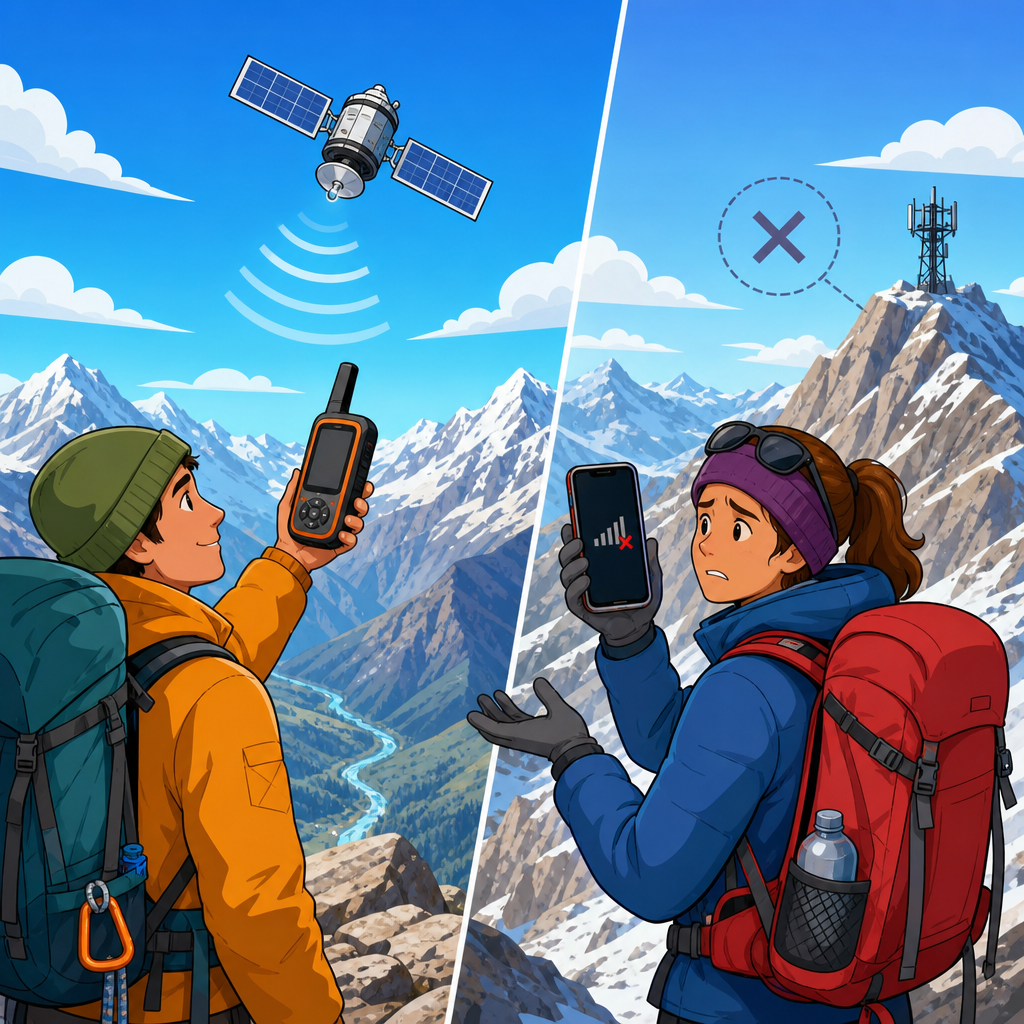
In plain terms, a cell phone is a multi-tool that becomes weak when infrastructure disappears. A satellite messenger is a single-purpose safety tool that keeps working when the map becomes bigger than the network. The distinction matters because remote altitude travel is defined by exactly those infrastructure gaps. If your route crosses glaciers, passes, plateaus, desert ranges, or undeveloped cordillera terrain, the question is not whether a phone can sometimes work. The question is what still works when conditions are worst.

Coverage, reliability, and emergency response

The most important difference is reliability during a true emergency. A dedicated satellite messenger gives you a built-in SOS pathway to a professional monitoring center, such as Garmin Response for inReach devices. When you trigger SOS, your coordinates, account details, and two-way message capability can support triage, relay medical information, and improve rescue coordination. Two-way messaging is critical. It lets rescuers ask about injuries, weather, landing zones, mobility, and group size. That can affect whether they send a helicopter, a ground team, or tell you to shelter in place.

By contrast, a cell phone emergency call is excellent when service exists, but less useful when you move in and out of intermittent coverage. One bar on a ridge is not the same as dependable communication. Text messages may occasionally transmit when calls fail, and modern phones can share location through apps, but these functions remain tied to network availability and battery-hungry software. In rescue terms, intermittent communication introduces ambiguity, and ambiguity costs time.

Factor Satellite Messenger Cell Phone
Primary network Satellite constellation Terrestrial cell towers
Best use case Remote areas with no service Connected areas and daily navigation
Emergency signaling Dedicated SOS with monitoring center 911 or local emergency call if service exists
Battery endurance Usually longer in tracking or standby Usually shorter with maps, camera, and cold exposure
Messaging Reliable but slower and limited Fast and easy when signal exists
Navigation Basic on many models Excellent with offline maps apps

Real-world example: on a 4,500-meter approach in the Andes, a team may have no mobile coverage from the trailhead onward. If one climber develops high altitude pulmonary edema, the need is not a weather app or a fast keyboard. The need is a guaranteed SOS pathway and the ability to tell responders that the patient is conscious, oxygen saturation is dropping, descent has begun, and a mule track is the nearest access point. That is the environment where satellite devices justify their cost immediately.

Navigation, mapping, and situational awareness

Cell phones dominate navigation because their screens are larger, faster, and easier to interpret. With apps like Gaia GPS, CalTopo, onX Backcountry, FATMAP heritage layers now integrated into other platforms, or Organic Maps, a phone can store topographic maps, satellite imagery, GPX tracks, slope angle shading, and waypoint notes. For safety and navigation, that matters every hour, not just during emergencies. You can confirm a descent gully, identify a water source, mark crevasse zones, and compare planned pace to actual movement.

Most satellite messengers offer only basic mapping and breadcrumb tracking. Some hybrid devices, such as the Garmin GPSMAP and inReach ecosystem, improve on that, but interface limitations remain. Composing messages on small buttons or tiny touchscreens with gloves on is slower than using a phone. If your goal is route efficiency, terrain interpretation, and day-to-day decision support, the phone usually does more. That is why experienced parties often navigate with a phone and protect the communication backbone with a messenger.

However, navigation confidence can become overconfidence. I have seen travelers assume offline maps eliminate the need for paper backup or a compass. At altitude, devices freeze, drop, or drain unexpectedly. Whiteout, avalanche terrain, and glacier travel demand layered navigation: offline maps on a phone, route and check-in capability on a satellite device, and at minimum a paper overview map with compass skills. For expeditions, adding a dedicated GNSS unit can make sense because it separates navigation from your communication chain.

Battery performance, durability, and altitude stress

Cold is the silent saboteur in altitude travel. Lithium-ion batteries lose effective capacity as temperatures drop, and phones suffer more because they are doing more. Screen brightness, camera use, constant GPS polling, downloaded maps, Bluetooth, and photo or video capture all drain power. At 3,500 meters and above, especially in wind, a phone that lasts all day in town may die before evening unless it is insulated and rationed. Keeping it in an inner layer pocket helps, but that also creates condensation risk when moving between cold air and body heat.

Dedicated satellite messengers typically win on endurance because they are optimized for low-power communication and tracking. A Garmin inReach Mini 2, for example, is designed for days to weeks of use depending on tracking interval and message volume. That matters on multi-day traverses where solar input is poor or where carrying large power banks is impractical. For winter ascents, I treat battery planning as a safety system: phone in airplane mode with offline maps downloaded, messenger with a confirmed charge and preset contacts, power bank stored warm, charging cables tested, and usage windows defined before departure.

Durability also favors dedicated devices. Many messengers are built for impact resistance, weather exposure, and glove-friendly operation. Phones have improved with IP ratings and rugged cases, but cracked screens and wet charging ports remain common field failures. Altitude amplifies every weakness because wind, spindrift, and stress make fine motor tasks harder. In practical terms, the more your emergency device resembles a simple appliance, the better it performs when you are tired, hypoxic, and cold.

Costs, subscriptions, and the myth of one-device savings

Cost is often the main reason travelers hesitate to buy a satellite messenger. A quality device can cost a few hundred dollars, and most require a monthly or annual plan. On paper, a phone seems cheaper because you already own one. In reality, comparing the devices only by purchase price misses the risk profile. Communication redundancy is part of the budget for remote altitude travel, just like insulation, avalanche gear, or insurance. The real question is the cost of not being able to call for help when a storm closes a pass or a partner cannot descend.

That said, cost tradeoffs are real. If your trips stay near populated mountain regions with consistent coverage, a phone plus disciplined planning may be enough. If you guide, climb internationally, or spend nights beyond roads and towers, the subscription becomes easy to justify. Rental options are also strong. Many outdoor stores, guide services, and expedition outfitters rent inReach or SPOT devices, which is useful for travelers testing a workflow before committing to a purchase.

Also consider hidden phone costs. Replacing a drained or broken phone can remove your maps, camera, payment method, permits, and contact list in one event. Putting all critical functions on one device looks efficient until that device fails. In safety management, single-point failure is the hazard to eliminate.

How to choose the right setup for your trip

The best choice depends on terrain, duration, remoteness, party size, and consequence of delay. For a day hike on a popular alpine trail with known service, a phone with offline maps, a charged power bank, and a shared itinerary may be adequate. For a multi-day high route, glacier approach, backcountry ski traverse, or remote desert mountain expedition, bring both. Make the satellite messenger the primary emergency channel and the phone the primary navigation and planning tool.

Here is the practical hub framework I recommend for safety and navigation. Start with route research: study maps, recent conditions, weather models, bailout points, and local emergency numbers. Build navigation layers: offline maps on at least one phone, paper backup, and clear waypoints for trailheads, camps, water, and exits. Add communication layers: satellite messenger with tested contacts and preset messages, plus a phone that is usable if service appears. Define medical and rescue thresholds: when will you descend, when will you call for help, and who at home knows your overdue time? Finally, build power discipline: battery percentages at start, charging schedule, and cold protection.

If you are deciding between devices today, use this rule. Choose a satellite messenger if you will be outside dependable coverage, if rescue delay could become life threatening, or if your route includes altitude where weather and illness can deteriorate quickly. Keep using a phone because it remains the best pocket navigation platform available. Safety and navigation in the mountains are strongest when communication is redundant, navigation is offline-capable, and the plan is simple enough to execute under stress.

The core takeaway is straightforward. A cell phone is a powerful tool for maps, weather checks, photos, and routine communication, but it is constrained by towers, cold, and battery drain. A satellite messenger is narrower in function yet far more dependable when remote altitude travel becomes an actual emergency. That reliability is why climbers, guides, expedition medics, and mountain rescue planners consistently prioritize dedicated satellite communication for serious objectives. The decision is not about abandoning the phone; it is about assigning each device the job it performs best.

As the hub for Safety and Navigation within Gear, Monitoring and Safety, this topic connects every other decision you make in the field. Route planning, altitude illness monitoring, weather interpretation, check-in protocols, battery strategy, and emergency response all depend on communication that matches the environment. If you are building a kit for remote mountain travel, start by fixing the weakest link: assume the phone may fail when you need it most, and add a satellite messenger before the trip that truly tests your margin.

Review your next route, mark where cell service realistically ends, and choose your communication setup accordingly. If the terrain is remote, exposed, or high consequence, carry both devices, test them before departure, and make sure everyone in the group knows the plan. Better communication does not remove mountain risk, but it shortens uncertainty, improves rescue coordination, and gives you a more reliable path home.

Frequently Asked Questions

Is a satellite messenger better than a cell phone for remote altitude travel?

In most true remote altitude environments, a satellite messenger is the more reliable safety tool, while a cell phone remains a useful secondary device. The reason is simple: a cell phone depends on ground-based towers, and mountain terrain, deep valleys, weather, and sparse infrastructure often interrupt or eliminate that coverage entirely. At altitude, even if a phone shows a weak signal on a ridge, service can disappear the moment you descend into a basin, move behind rock walls, or encounter storms. A satellite messenger, by contrast, is designed to communicate through satellite networks in places where terrestrial coverage is unavailable or inconsistent.

That does not mean a satellite messenger replaces a phone in every respect. A phone is still excellent for downloaded maps, camera use, weather apps before losing service, trip planning, and communication anywhere a network exists. But for emergency signaling, check-ins, and location sharing when conditions deteriorate, the satellite messenger usually provides a much larger margin of safety. In remote altitude travel, that margin matters because small delays can turn serious quickly when cold, exhaustion, altitude illness, injury, or whiteout conditions are involved. The best way to think about the comparison is not “which gadget is cooler,” but “which device still works when the environment is actively removing my options.” In that scenario, the satellite messenger is usually the device you want on your person.

Can a cell phone work at high altitude if I am far from towns or roads?

Yes, sometimes, but “sometimes” is not a dependable safety strategy. High altitude alone does not guarantee better reception. Many travelers assume elevation automatically improves cellular performance because they are physically higher, but actual connectivity depends on line of sight to cell towers, the density of local infrastructure, carrier coverage, network congestion, and terrain blocking. In mountain regions, ridgelines may briefly expose you to a signal, while nearby cirques, canyons, glaciers, forested drainages, and steep rock faces can block service almost completely.

Weather and battery performance also complicate things. Cold temperatures can sharply reduce battery efficiency, and at altitude people often use phones more heavily for photos, GPS tracking, route finding, and weather checks, which drains power faster. If your phone is your only communication device, that combination of intermittent service and power loss creates obvious risk. Even newer phones with emergency satellite features can have important limitations: they may support only basic emergency communication, may require clear sky view and specific positioning, and may not offer the same two-way messaging, breadcrumb tracking, or expedition-oriented functions as a dedicated satellite messenger.

The practical takeaway is that a cell phone should be treated as an opportunistic communication tool in remote altitude travel, not as your sole lifeline. If it works, great. If it does not, your plan should still be intact. That means offline maps, spare power, prearranged check-in protocols, and ideally a satellite device that can send messages and trigger SOS independent of mobile networks.

What are the main safety advantages of a satellite messenger during a mountain emergency?

The biggest advantage is predictable access to emergency communication when ordinary infrastructure is absent. In a mountain emergency, the critical question is not whether you can call for help under ideal conditions, but whether you can communicate when someone is injured, hypothermic, disoriented, or developing altitude illness in poor weather or failing light. A satellite messenger is built for exactly that problem. It typically provides SOS capability, GPS-based location transmission, preset or custom messaging, and in many cases ongoing two-way communication with emergency coordination services or contacts at home.

That two-way element is especially valuable. It can allow rescuers or response coordinators to understand the nature of the incident, the number of people involved, the injuries or symptoms present, changing weather, and whether self-evacuation is still possible. That information can improve rescue prioritization and reduce wasted time. In altitude environments, rescue timelines matter because conditions often worsen quickly. A twisted ankle in mild weather can become a night exposure incident if movement stops. Mild acute mountain sickness can progress. A navigational error can become a full immobilization problem after snowfall or darkness. Communication that includes exact coordinates and updates can dramatically improve the odds of an efficient response.

Another major benefit is routine, non-emergency messaging. The ability to send check-ins, delay notices, or route updates reduces uncertainty for family, expedition leaders, and support teams. If your group misses a planned exit but has already sent a message explaining a weather delay or route change, that can prevent confusion and help others make better decisions on your behalf. In short, a satellite messenger improves not only rescue access, but also incident prevention, response clarity, and the overall management of uncertainty in places where uncertainty carries real consequences.

Do I need both a satellite messenger and a cell phone for remote altitude travel?

For many travelers, yes—the strongest setup is both devices used for different roles. A cell phone is a highly capable multi-tool: it stores offline maps, route notes, permits, medical information, weather forecasts obtained before departure, and sometimes avalanche, topographic, or navigation apps. It is also familiar, fast to use, and effective whenever service is available. A satellite messenger, meanwhile, covers the communication gap when service disappears and provides a dedicated emergency pathway that does not rely on local towers.

Carrying both also creates redundancy, which is a core principle of risk management in mountain travel. Redundancy matters because failures rarely happen one at a time. A phone can break in a fall, freeze, run out of battery, or fail to connect. A satellite device can be blocked temporarily by terrain, misplaced, or discharged if not managed properly. Having two systems gives you more options and reduces dependence on a single point of failure. That is especially important during solo travel, small-team travel, winter objectives, multi-day traverses, and any route where retreat is difficult or rescue access is slow.

That said, whether you “need” both depends on your route, remoteness, duration, skill level, season, group size, and consequence of isolation. A short hike near a developed mountain corridor is different from a weeklong ski traverse or a remote alpine climb. The more remote the objective, the harsher the weather exposure, and the longer the self-rescue window, the stronger the argument for carrying both. If you choose only one, the dedicated satellite messenger is usually the more important safety device for remote altitude travel, but the smartest approach is to pair it with a phone, offline navigation, and disciplined power management.

What should I look for when choosing a satellite messenger instead of relying on my phone?

Start with the communication features that matter in real field conditions, not marketing language. First, look for dependable SOS functionality tied to a credible emergency response system. Second, prioritize true two-way messaging if your trips involve long durations, complex routes, or higher-consequence terrain. One-way beaconing can be useful, but two-way communication gives you and responders much more flexibility during an unfolding incident. Third, evaluate network coverage for the regions where you actually travel. Different satellite systems have different strengths depending on latitude, terrain exposure, and device behavior under partial sky view.

Battery life is another major factor. Cold, altitude, and long travel days can expose weaknesses quickly, so choose a device with battery performance suited to your trip length and season. Tracking intervals, message frequency, and navigation features all affect endurance, so match the device to your use case instead of assuming more features are always better. Durability, water resistance, glove-friendly controls, and simplicity also matter more than many buyers expect. In a storm, with numb hands or low visibility, a rugged device with intuitive operation is more valuable than one packed with rarely used extras.

You should also consider subscription structure, message limits, and whether the device integrates sensibly into your emergency plan. Can your contacts receive updates easily? Can you share location breadcrumbs? Is it simple to communicate a delay without triggering alarm? Finally, remember that no device solves poor judgment. A satellite messenger is a safety layer, not permission to accept avoidable risk. The best choice is the device you understand thoroughly, keep powered, carry accessibly on your body rather than buried in a pack, and integrate with sound planning, acclimatization, conservative decision-making, and reliable navigation practices.

Gear, Monitoring & Safety, Safety & Navigation

Post navigation

Previous Post: Best first-aid kit additions for high-altitude hiking
Next Post: Power banks that hold up better in winter conditions

Related Posts

How to choose gloves for cold but sunny alpine days Clothing, Sleep & Shelter
Best layering system for big temperature swings in the mountains Clothing, Sleep & Shelter
Best base layers for dry, cold mountain climates Clothing, Sleep & Shelter
How to pick a sleeping bag for high-altitude camping Clothing, Sleep & Shelter
Best sleeping pads for cold ground and thin air Clothing, Sleep & Shelter
Best pulse oximeters for altitude travel Gear, Monitoring & Safety

Pages

  • Privacy Policy
  • Welcome to HighAltitudeLife.com — Your Complete Guide to Living, Traveling, and Thriving at Elevation

Posts by category

  • Category: Altitude Illness & Acclimatization
    • Can you lose acclimatization after a few days back at sea level?
    • Does sleeping in a lower town really make a difference?
    • Can heat training replace altitude acclimatization?
    • Can sauna training help you prepare for altitude?
    • Do hypoxic tents work for high-altitude travel?
    • Can a weekend trip help you pre-acclimate for a bigger mountain trip?
    • Do altitude masks help with acclimatization?
    • Should you use HRV to monitor altitude adaptation?
    • How to track acclimatization with resting heart rate
    • Low SpO2 at altitude without symptoms: should you worry?
    • What is a normal oxygen saturation at 8,000 feet?
    • How to use a pulse oximeter at altitude without overreacting
    • How fast high-altitude pulmonary edema can progress after a rapid ascent
    • Why HAPE can happen even without classic altitude sickness first
    • What pink frothy sputum at altitude means and why it is an emergency
    • When chest tightness at altitude means you need to descend now
    • HAPE vs bronchitis: how to spot a dangerous cough at altitude
    • Early signs of HAPE every traveler should know
    • How quickly HACE can become life-threatening if you keep ascending
    • What to do if someone becomes disoriented at high altitude
    • HACE vs severe AMS: when symptoms cross into emergency territory
    • Why stumbling and confusion at altitude should never be ignored
    • Early signs of HACE that people mistake for simple exhaustion
    • Why descent is still the most important treatment for severe altitude illness
    • What to do if someone collapses at altitude
    • What to do if AMS hits on night one in a ski town
    • When to descend immediately because altitude symptoms are getting worse
    • When to go to urgent care for altitude symptoms
    • Why altitude symptoms often peak on the first night
    • Why you feel hungover at altitude even when you did not drink
    • Shortness of breath at altitude: what is normal and what is not
    • Why your hands and face can feel puffy after gaining elevation
    • Why your resting heart rate jumps after a rapid ascent
    • Altitude fatigue vs normal travel fatigue: how to tell the difference
    • Why dizziness at altitude feels worse when you stand up quickly
    • Loss of appetite at high altitude: when to push calories and when to rest
    • What causes nausea at altitude and what actually helps?
    • Acute mountain sickness symptoms timeline: what can start within 6 to 12 hours
    • Can poor sleep be your first sign that altitude is not going well?
    • Do anti-nausea meds help with altitude sickness?
    • How long should you wait before trying to go higher again after AMS?
    • Why appetite loss at altitude can quietly make symptoms worse
    • Can dehydration alone cause an altitude-like headache?
    • What not to do when you get altitude sick in a resort town
    • How to use rest days correctly while acclimatizing
    • Why mild altitude symptoms should change your next day’s plan
    • Can you get altitude sickness after moving higher within the same mountain region?
    • Why altitude illness symptoms can look like a hangover
    • Why some people get altitude sickness below the usual risk threshold
    • Do older adults acclimate more slowly at high altitude?
    • Do children get altitude sickness differently than adults?
    • What travelers usually miss about the altitude where they sleep
    • How altitude sickness feels different when you fly in vs drive up
    • Can you still get altitude sickness if you were fine last time?
    • What happens if you ignore mild altitude sickness symptoms?
    • How to know whether a mountain headache is just a headache or AMS
    • Why physical fitness does not protect you from altitude sickness
    • First-night altitude sickness: what to do before symptoms spiral
    • Why altitude sickness often feels worse after dinner
    • What does mild altitude sickness feel like at night?
    • How quickly can altitude sickness start after you arrive?
    • Can you get altitude sickness at 6,000 feet?
    • Altitude sickness vs dehydration: how to tell the difference on day one
    • When oxygen helps at altitude and when it is not enough
    • Can ibuprofen help with altitude headache?
    • What medications can make altitude sleep worse?
    • How long does acetazolamide take to start working?
    • Acetazolamide vs dexamethasone for altitude illness prevention
    • Acetazolamide side effects: what is normal and what is not
    • When should you take acetazolamide for high altitude travel?
    • Category: Acclimatization Plans
      • How to build a week-long acclimatization plan for a 14er trip
      • Driving to altitude vs flying to altitude: which is easier on your body?
      • How to acclimatize after flying straight from sea level to the mountains
      • How to acclimatize for a mountain wedding or family reunion
      • Why symptoms often improve during the day and worsen overnight
      • How many buffer nights do you need before going higher?
      • What climb high, sleep low actually means for normal travelers
      • Why sleeping altitude matters more than daytime altitude
      • How staged ascent lowers your risk of getting sick
      • Should you rest or exercise on your first day at altitude?
      • What a good first 48 hours at altitude actually looks like
      • How long does acclimatization take for a ski vacation?
      • How long does it take to acclimatize after moving to 6,500 feet?
      • How to acclimatize when you only have one extra day
      • Acclimatization plan for 8,000 to 10,000 feet
    • Category: Altitude Medications & Oxygen
    • Category: AMS Basics & Risk Factors
    • Category: AMS Management & Recovery
    • Category: AMS Symptoms & Diagnosis
    • Category: Descent, Treatment & Emergency Response
    • Category: HACE
    • Category: HAPE
    • Category: Monitoring & Decision Tools
    • Category: Pre-Acclimation & Training
  • Category: Cooking & Baking at Altitude
    • Can you cold ferment bread dough at altitude?
    • Biscuits at altitude: how to keep them flaky and tall
    • Best high altitude strategy for enriched doughs
    • How altitude changes sourdough discard recipes
    • Why your crust hardens too fast at altitude
    • Should you use bread flour or all-purpose flour at altitude?
    • How to proof dough in a cold mountain kitchen
    • Challah at altitude: how to keep braids tall and even
    • Focaccia at altitude without giant air tunnels
    • High altitude bagels: better chew without overproofing
    • Bread machine baking at altitude: how to stop overflow and collapse
    • High altitude cinnamon rolls that stay soft
    • How to fix dry dinner rolls at altitude
    • Pizza dough at altitude: timing bulk fermentation correctly
    • Whole wheat bread at altitude without a dense crumb
    • Why bread loaves collapse after rising beautifully at altitude
    • High altitude sourdough hydration: how to adjust for dry flour
    • How to make soft sandwich bread at altitude
    • Sourdough at altitude: how to manage a hyperactive starter
    • High altitude bread baking: how to slow overproofing
    • Why yeast dough rises too fast at altitude
    • Best oven rack position for muffins and quick breads at altitude
    • What high altitude does to buttermilk baking
    • Pumpkin bread at altitude without collapse
    • Cinnamon streusel muffins at altitude that actually hold together
    • Zucchini bread at altitude without a wet middle
    • Crepes at altitude: do you need to change anything?
    • Scones at altitude: why they spread and how to fix them
    • Waffles at altitude: crisp outside, fully cooked inside
    • Pancakes at altitude: why they turn gummy in the middle
    • Cornbread at altitude: moist texture without crumbling
    • Blueberry muffins at altitude without gummy centers
    • Quick breads at altitude: why they over-rise and collapse
    • Banana bread at altitude: how to stop the center from sinking
    • Muffins at altitude: how to avoid mushroom tops and tunnels
    • High altitude pastry cream without a grainy texture
    • Why whipped cream behaves differently in very dry climates
    • Best thickener choices for fruit pies at altitude
    • Souffles at altitude: why timing matters even more
    • How to blind bake pie crust successfully at altitude
    • Custards at altitude: how to avoid curdling and underbaking
    • Tart shells at altitude without slumping
    • How to fix hollow macarons in dry mountain air
    • Puff pastry at altitude: what matters and what does not
    • Cream puffs and choux pastry at altitude
    • Meringue at altitude: how to stop weeping and shrinking
    • Macarons at altitude: can they actually work?
    • Pumpkin pie at altitude without cracks or weeping
    • Pie crust at altitude: how to keep it flaky
    • Fruit pies at altitude: how to avoid runny fillings
    • Coffee brewing at altitude: how to get better extraction
    • Grilling at altitude: how wind and thinner air change cooking
    • Instant Pot altitude adjustments that actually work
    • Pressure cooking at altitude for soups and stews
    • Roasting meat at altitude: why thermometers beat timing
    • Slow cooker meals at altitude: do you need to adjust time?
    • Beans at altitude: stovetop vs pressure cooker
    • Cooking rice at altitude without mush or crunch
    • Pasta at altitude: why it takes longer than you expect
    • How long to boil eggs at altitude
    • Category: Baking Fundamentals
      • How altitude affects gluten-free baking
      • Best tools for reliable high altitude baking at home
      • How to test a new recipe at altitude without wasting ingredients
      • Why eggs matter more in high altitude baking
      • How much extra liquid to add when baking at altitude
      • When to reduce baking powder and baking soda at altitude
      • When to reduce sugar in high altitude baking
      • When you should increase oven temperature at altitude
      • Why your flour behaves differently in dry mountain air
      • Why water boils at a lower temperature at altitude and why it matters
      • High altitude baking conversion chart for beginners
      • How to adjust a sea-level recipe for high altitude
      • Why low air pressure changes rise, moisture, and structure
      • High altitude baking basics: why recipes fail above 3,000 feet
      • What counts as high altitude for baking?
    • Category: Baking Troubleshooting & Workflow
      • Best freezer strategies for make-ahead baking at altitude
      • How to troubleshoot overproofed bread in a dry mountain kitchen
      • Best notebook system for testing and improving high-altitude recipes
      • Why pie fillings bubble differently at altitude
      • How to adapt family recipes without losing the original feel
      • How to adjust cheesecake water baths at altitude
      • Can you use convection mode for high-altitude baking?
      • What altitude does to brownie edges vs brownie centers
      • Why high-altitude cakes brown before the center is done
      • How to rescue a batch of flat cookies at altitude
    • Category: Cakes & Cupcakes
      • High altitude wedding cake planning for home bakers
      • How to keep sheet cakes soft at altitude
      • Bundt cakes at altitude: why they stick and how to fix it
      • Sponge cake at altitude: how to stabilize the foam
      • Cheesecake at altitude: how to avoid cracks and underbaked centers
      • Angel food cake at altitude: how to keep it from collapsing
      • High altitude red velvet cake without a dense crumb
      • How to keep layer cakes from drying out at altitude
      • Best frosting choices for dry mountain climates
      • How to adapt box cake mix for 5,000 to 8,000 feet
      • Why cupcakes dome and crack at altitude
      • High altitude vanilla cake: how to prevent tunneling and collapse
      • How to fix a gummy cake at altitude
      • Why cakes sink in the middle at high altitude
      • High altitude chocolate cake that stays moist and tall
    • Category: Candy, Preserves & Canning
      • Best thermometer use for sugar work at high altitude
      • Altitude-safe fruit preserving for mountain home cooks
      • Why home canning mistakes are riskier at altitude
      • Pressure canning at altitude: how to adjust pressure safely
      • Boiling-water canning at altitude: how to adjust processing time
      • High altitude canning basics for beginners
      • Jam and jelly at high elevation: safer set points and timing
      • Fudge at altitude without graininess
      • Caramel at altitude: why your thermometer matters more
      • Candy making at altitude: how soft-ball and hard-crack stages change
    • Category: Cookies & Bars
      • Should you chill cookie dough longer at altitude?
      • Best pan choice for cookies at high altitude
      • Peanut butter cookies at altitude: how to stop cracking
      • High altitude lemon bars without a soggy crust
      • Why blondies turn cakey at altitude
      • Snickerdoodles at altitude: why they flatten and how to fix them
      • Shortbread at altitude: how to keep it tender
      • Bar cookies at altitude: how to avoid underbaked centers
      • Brownies at altitude: chewy edges without a dry center
      • Fudgy brownies at 7,000 feet: the easiest adjustments
      • Best high altitude oatmeal cookie adjustments
      • High altitude sugar cookies that hold their shape
      • High altitude chocolate chip cookies that do not go flat
      • Why cookies spread too much at altitude
      • How to fix dry cookies at altitude
    • Category: Cooking Methods
    • Category: Pies, Pastries & Meringues
    • Category: Quick Breads & Breakfast Bakes
    • Category: Yeast Breads & Sourdough
  • Category: Daily Life, Skin, Eyes & Home Comfort
    • Best lip SPF for high elevation conditions
    • How to protect your scalp from altitude sun
    • Sunburn on cloudy mountain days: why it still happens
    • How to read the UV Index before a mountain hike
    • Best UPF clothing for high altitude summer days
    • Best sunscreen for high altitude hiking and snow reflection
    • How often should you reapply sunscreen while skiing?
    • How altitude changes eczema triggers
    • Does acne get better or worse at altitude?
    • Why UV exposure is stronger at altitude
    • How to treat a nose that feels raw in dry mountain weather
    • Best overnight routine for repairing skin after sun and wind exposure
    • Windburn vs sunburn: how to tell the difference after a mountain day
    • How to stop chapped lips from coming back in mountain air
    • Why your hands crack faster at altitude and what helps
    • Best moisturizers for mountain dryness without feeling greasy
    • How to build a high altitude skincare routine that actually works
    • How to reduce fatigue during your first month at altitude
    • Does allergy season get better or worse at higher elevation?
    • Why your skin gets drier at 7,000 feet
    • How to dress for 40-degree temperature swings in one day
    • Why coffee tastes different in the mountains
    • What shoulder season living is really like in mountain towns
    • How to dry laundry faster in cold, dry air
    • Best pet hydration routine for mountain homes
    • How to keep houseplants alive at altitude
    • Best place to put a humidifier in a mountain bedroom
    • Best houseplants for adding humidity in dry climates
    • How to reduce nosebleeds caused by dry indoor air
    • Static electricity at altitude: why it gets so bad
    • How to use a bedroom humidifier without creating mold
    • Why your sinuses hurt more in dry mountain houses
    • How to keep produce fresh longer in mountain air
    • Indoor humidity at altitude: what range feels best?
    • Humidifier vs whole-house humidifier for mountain homes
    • How to protect your eyes on windy ridge days
    • Do blue eyes burn faster in bright snow conditions?
    • Can altitude make contact lenses less comfortable?
    • What photokeratitis feels like and when to get help
    • How to prevent snow blindness on bright alpine days
    • When should you wear glacier glasses instead of regular sunglasses?
    • Best eyedrops for mountain dryness and screen time
    • Dry eyes at high altitude: what actually helps
    • What altitude does to your taste and smell
    • Why groceries dry out faster in a mountain pantry
    • Best food storage tweaks for dry, high-elevation kitchens
    • How to manage barometric pressure headaches in mountain towns
    • Why weather swings trigger headaches at altitude
    • Daily hydration habits that work when you live at altitude
    • How to create an altitude-friendly self-care routine for guests
    • Do storms feel more intense when you live high in the mountains?
    • Why you feel thirstier in cold mountain weather
    • Why your voice feels rough after a day in dry mountain weather
    • How to prevent cracked cuticles and hangnails at altitude
    • Can altitude make tinnitus feel worse?
    • How to soothe a dry sore throat caused by mountain air
    • High altitude cough: dry air vs illness vs something serious
    • Why your nose bleeds more often in winter at altitude
    • Sinus pressure after a big elevation gain: what helps safely
    • How to relieve ear pressure on mountain drives
    • Category: Comfort Troubleshooting
      • Why mountain air can make you feel tired even when your weather app says perfect
      • How to build a guest room that feels better for visitors new to altitude
      • Best ways to protect kids’ skin from mountain sun year-round
      • Do humidifiers help with snoring in dry mountain bedrooms?
      • How to keep your home office comfortable in dry mountain air
      • Best reusable water bottle habit for daily life at altitude
      • How to handle cold, sunny days that dehydrate you faster than you expect
      • Best shower and skincare routine after skiing at altitude
      • Can altitude make contact lenses dry out faster on flights and mountain days?
      • How to stop waking up with nosebleeds in winter mountain homes
    • Category: ENT & Sensory Issues
    • Category: Everyday Health & Comfort
    • Category: Eye Care & Vision
    • Category: Indoor Air & Humidity
    • Category: Lifestyle Adjustments
    • Category: Skin Care & Dryness
    • Category: Sun Protection & UV
  • Category: Family, Pregnancy & Kids
    • How to plan a lower-risk babymoon in a mountain town
    • When to call your OB before a mountain trip
    • Best hydration strategy for pregnancy in dry mountain air
    • Why remote mountain travel changes pregnancy risk planning
    • Pregnancy and brief high-altitude travel: practical planning questions
    • Can you ski early in pregnancy at altitude?
    • How to plan rest days on a high-altitude family trip
    • Can kids sleep worse than adults at altitude?
    • What to do if your child vomits after arriving at altitude
    • Traveling to altitude with a baby: what pediatricians usually discuss
    • Best snacks for children who lose appetite at altitude
    • How to keep kids hydrated on mountain vacations
    • How to pace a family ski trip so kids acclimate better
    • Best first-day plan for families arriving at altitude
    • Best packing list for infants in high-altitude climates
    • What altitude symptoms in toddlers are easy to miss
    • How to spot altitude sickness in children
    • How to recognize when a baby is not adjusting well to altitude
    • Safe sleep questions parents ask after moving to altitude
    • Newborns at altitude: what families should ask their pediatrician
    • Postpartum recovery at altitude: what can feel harder than expected
    • Breastfeeding at altitude: how dry air and hydration affect comfort
    • Category: Family Logistics & Planning
      • How to build a kid-friendly first-aid kit for mountain trips
      • Should children take acetazolamide for altitude travel?
      • How to talk to kids about altitude sickness without scaring them
      • Family road trip to altitude: where to break up the ascent
      • How to plan a multigenerational vacation at altitude without overdoing it
      • Best family-friendly mountain towns for a first altitude trip
      • How to manage screen-free downtime when bad weather keeps kids inside
      • How to plan a family reunion in the mountains for mixed ages
      • High school athletes competing at altitude: how to prepare safely
      • Traveling with grandparents and kids to altitude: how to pace the trip
    • Category: Infants & Postpartum
    • Category: Kids & Family Travel
    • Category: Pregnancy Travel
  • Category: Fitness, Hiking & Performance
    • Best recovery routine after multiple ski days at altitude
    • Can altitude make you more reckless on the mountain?
    • How to reduce quad burnout on long ski days at altitude
    • Snowshoeing at altitude: how to avoid overheating and dehydration
    • Backcountry ski touring at altitude: pacing and fueling tips
    • How to stay hydrated while skiing in cold weather
    • Best acclimatization plan for a ski weekend
    • Skiing at altitude: how to survive day one without a headache
    • How to use perceived effort instead of pace at altitude
    • Do you lose fitness or just feel slower at elevation?
    • Why interval workouts feel brutal at altitude
    • Can you train hard on day one at altitude?
    • How to pace your first run in a mountain town
    • Why workouts feel harder at 6,000 feet
    • Heart rate zones at altitude: how to adjust them
    • How much does VO2 max drop at altitude?
    • Does creatine help or hurt during altitude adaptation?
    • Can you build muscle normally while living at altitude?
    • Can altitude make you sorer for longer after leg day?
    • How to recover from strength sessions in dry mountain climates
    • Should bodybuilders adjust protein and water needs at altitude?
    • Do heavy lifts feel harder at altitude or is it just cardio strain?
    • Best gym week after moving to altitude
    • Strength training at altitude: should you cut volume or intensity first?
    • How long altitude training benefits last after you come home
    • Can altitude training help a half marathon at sea level?
    • How to avoid altitude headaches after a run
    • Best recovery plan after a hard run at altitude
    • Best acclimatization strategy for trail runners
    • How to train for your first 14er from sea level
    • How to fuel long runs in dry mountain air
    • How to know whether fatigue is from training or acclimatization
    • Running at altitude: what sea-level runners should expect
    • High altitude muscle cramps: hydration vs sodium vs pacing
    • Post-workout headaches at altitude: most common causes
    • Should you add extra recovery days during your first week at altitude?
    • Signs you are pushing too hard at altitude
    • Best active recovery ideas when you live above 7,000 feet
    • How altitude affects hiking with a pack vs running without one
    • Using a pulse oximeter to guide training at altitude
    • Can you train through mild altitude sickness?
    • How to return to sea-level pace after a high-altitude block
    • Do women respond differently to altitude training than men?
    • Can swimmers benefit from altitude exposure away from the pool?
    • Heat training vs altitude training: which is more useful?
    • Best cross-training options during your first altitude week
    • Live high, train low: what it really means for non-elite athletes
    • How to plan a training camp at altitude without burning out
    • How to build rest breaks into a family hike at altitude
    • Why appetite changes can wreck athletic performance at altitude
    • Altitude and weight loss: why the scale may drop fast at first
    • Best snacks for summit day above tree line
    • How to plan a safer turnaround time at altitude
    • Breathing techniques that actually help on steep ascents
    • How often should you stop on a high-altitude hike?
    • What to do when your hiking partner is slowing down from altitude
    • How to pace steep climbs so you do not blow up early
    • Hiking at altitude when you are not acclimated
    • Category: Cycling
      • What to eat on a high-altitude ride over three hours
      • Mountain biking at altitude: how to manage surges and recovery
      • Do descents feel colder and drier at altitude on the bike?
      • Best gearing strategy for steep high-altitude climbs
      • How altitude changes power output on the bike
      • Cycling mountain passes: how to pace long climbs at altitude
    • Category: Hiking Strategy
    • Category: Performance Strategy
    • Category: Recovery & Monitoring
    • Category: Running & Endurance
    • Category: Strength & Gym Training
    • Category: Training Physiology
    • Category: Winter Sports
  • Category: Gear, Monitoring & Safety
    • Best headlamps for cold mountain nights
    • Power banks that hold up better in winter conditions
    • Satellite messenger vs cell phone for remote altitude travel
    • Best first-aid kit additions for high-altitude hiking
    • Do trekking poles really help at altitude?
    • Hydration packs that resist frozen hoses in winter
    • Best water bottles for cold, high-altitude hikes
    • Best thermometers for high-altitude cooking and candy making
    • Do you need a humidifier for mountain hotel rooms?
    • Oxygen canisters for hikers: helpful tool or marketing gimmick?
    • How to read a pulse oximeter without panicking
    • Portable oxygen concentrators for high altitude travel: what they can and cannot do
    • Best pulse oximeters for altitude travel
    • Category: Clothing, Sleep & Shelter
      • Tent features that matter most in exposed alpine camps
      • Best sleeping pads for cold ground and thin air
      • How to pick a sleeping bag for high-altitude camping
      • Best base layers for dry, cold mountain climates
      • Best layering system for big temperature swings in the mountains
      • How to choose gloves for cold but sunny alpine days
    • Category: Monitoring & Oxygen
    • Category: Safety & Navigation

My Templates

  • Default Kit
  • Default Kit

  • Acclimatization Plans
  • Altitude Illness & Acclimatization
  • Altitude Medications & Oxygen
  • AMS Basics & Risk Factors
  • AMS Management & Recovery
  • AMS Symptoms & Diagnosis
  • Baking Fundamentals
  • Baking Troubleshooting & Workflow
  • Cakes & Cupcakes
  • Candy, Preserves & Canning
  • Clothing, Sleep & Shelter
  • Comfort Troubleshooting
  • Cookies & Bars
  • Cooking & Baking at Altitude
  • Cooking Methods
  • Cycling
  • Daily Life, Skin, Eyes & Home Comfort
  • Descent, Treatment & Emergency Response
  • ENT & Sensory Issues
  • Everyday Health & Comfort
  • Eye Care & Vision
  • Family Logistics & Planning
  • Family, Pregnancy & Kids
  • Fitness, Hiking & Performance
  • Gear, Monitoring & Safety
  • HACE
  • HAPE
  • Hiking Strategy
  • Indoor Air & Humidity
  • Infants & Postpartum
  • Kids & Family Travel
  • Lifestyle Adjustments
  • Monitoring & Decision Tools
  • Monitoring & Oxygen
  • Performance Strategy
  • Pies, Pastries & Meringues
  • Pre-Acclimation & Training
  • Pregnancy Travel
  • Quick Breads & Breakfast Bakes
  • Recovery & Monitoring
  • Running & Endurance
  • Safety & Navigation
  • Skin Care & Dryness
  • Strength & Gym Training
  • Sun Protection & UV
  • Training Physiology
  • Winter Sports
  • Yeast Breads & Sourdough
  • Privacy Policy
  • Welcome to HighAltitudeLife.com — Your Complete Guide to Living, Traveling, and Thriving at Elevation

Copyright © 2026 .

Powered by PressBook Grid Blogs theme